We built a city-simulation to model the business infrastructure of a city and use density patterns throughout the user's preference selection to optimally suggest and help choose a location and evaluate the user's choice of location.
Business location can be the difference between success and struggle, but most entrepreneurs rely on intuition rather than science to pick the perfect spot. At Prime Plot, we’re driven to take the guesswork out of this process aiming to help aspiring business owners make informed decisions.
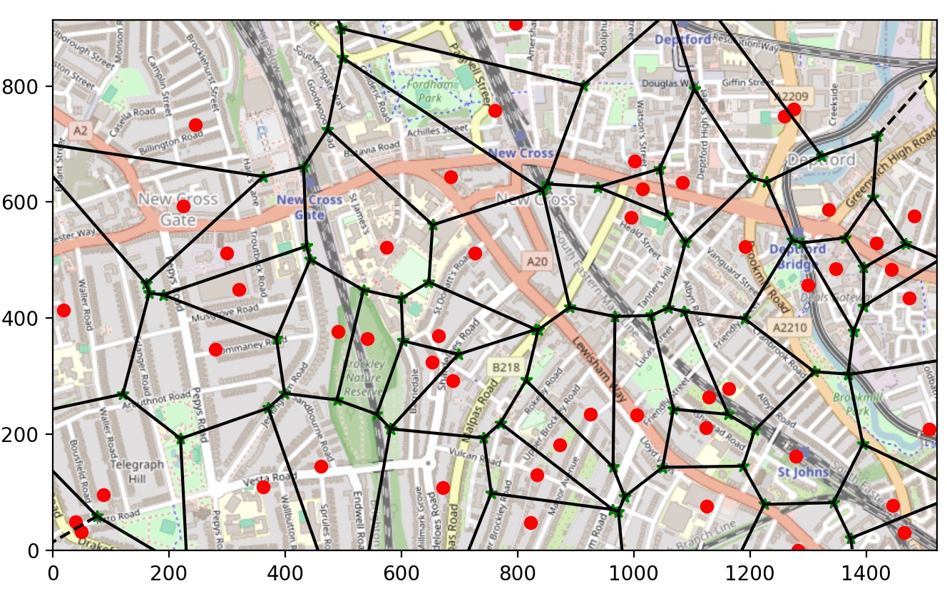
We are using Generalized Voronoi Diagrams (GVDs) to identify optimal business locations by evaluating proximity and minimizing competition. The red spots on the map represent existing businesses, while green spots represent the vertices of GVDs, which are potential locations suggested for new businesses. The lines, or GVD bisectors, form boundaries that divide areas based on their distance to nearby businesses. By placing new business locations on or near these green vertices, we ensure maximum coverage of the surrounding area while reducing overlap with established competitors. This helps identify strategically advantageous locations for new businesses.
Our hypothesis with using Generalized Voronoi Diagrams (GVDs) in Prime Plot is that positioning new businesses near GVD vertices will help maximize reach while minimizing direct competition. The GVD vertices, marked as green spots, are points of equidistance from surrounding competitors, represented by red spots on our map. By identifying these strategic points, we aim to suggest locations that are optimally placed between existing businesses, balancing accessibility to customers with minimal interference from nearby competitors.
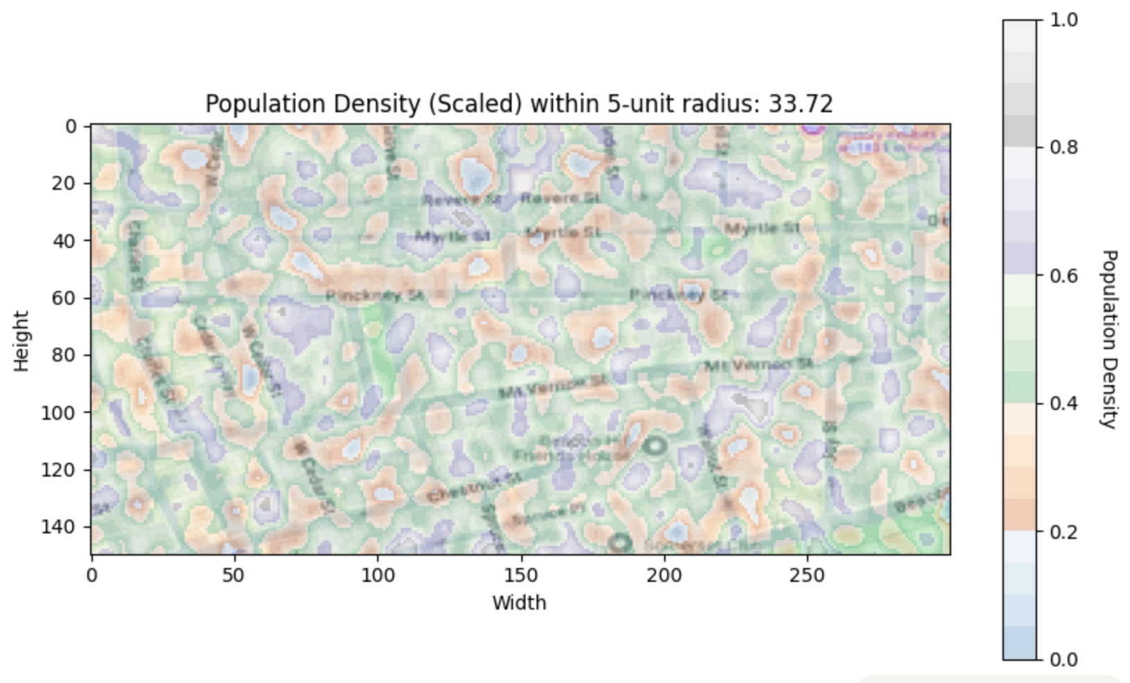
However, we recognize that GVDs alone don't capture the full complexity of a successful business location. Beyond just spatial distance, we factor in other key demographics, such as population density by age group, opening and closing time intervals of similar businesses, proximity to schools, office zones, and rental rates. By overlaying this demographic data with GVD-generated locations, we ensure that our recommendations align not only with spatial advantage but also with the specific needs and behaviors of the target customer base in each area. This approach allows us to fine-tune recommendations, making them both geographically strategic and deeply informed by the community profile, ultimately helping entrepreneurs choose locations that maximize their success potential.
This architecture diagram showcases our solution’s approach to suggesting optimal business locations by integrating spatial analysis with demographic features. Starting with essential features like population density, age demographics, rental costs, and operational timings, we leverage Generalized Voronoi Diagrams (GVDs) to pinpoint new, strategically located points based on existing business distributions. These potential locations undergo further statistical analysis, considering nearby businesses and relevant demographic data, to refine recommendations. Our solution also includes an explainability module powered by Large Language Models (LLMs), providing clear insights for user choices. Although not fully integrated, we envisioned a comparison feature using LLM agents to debate between two suggested locations, offering more robust decision-making support. This blend of algorithmic and machine-learning methods aims to maximize business reach while tailoring recommendations to local dynamics.
This architecture diagram showcases our solution’s approach to suggesting optimal business locations by integrating spatial analysis with demographic features. Starting with essential features like population density, age demographics, rental costs, and operational timings, we leverage Generalized Voronoi Diagrams (GVDs) to pinpoint new, strategically located points based on existing business distributions. These potential locations undergo further statistical analysis, considering nearby businesses and relevant demographic data, to refine recommendations. Our solution also includes an explainability module powered by Large Language Models (LLMs), providing clear insights for user choices. Although not fully integrated, we envisioned a comparison feature using LLM agents to debate between two suggested locations, offering more robust decision-making support. This blend of algorithmic and machine-learning methods aims to maximize business reach while tailoring recommendations to local dynamics.
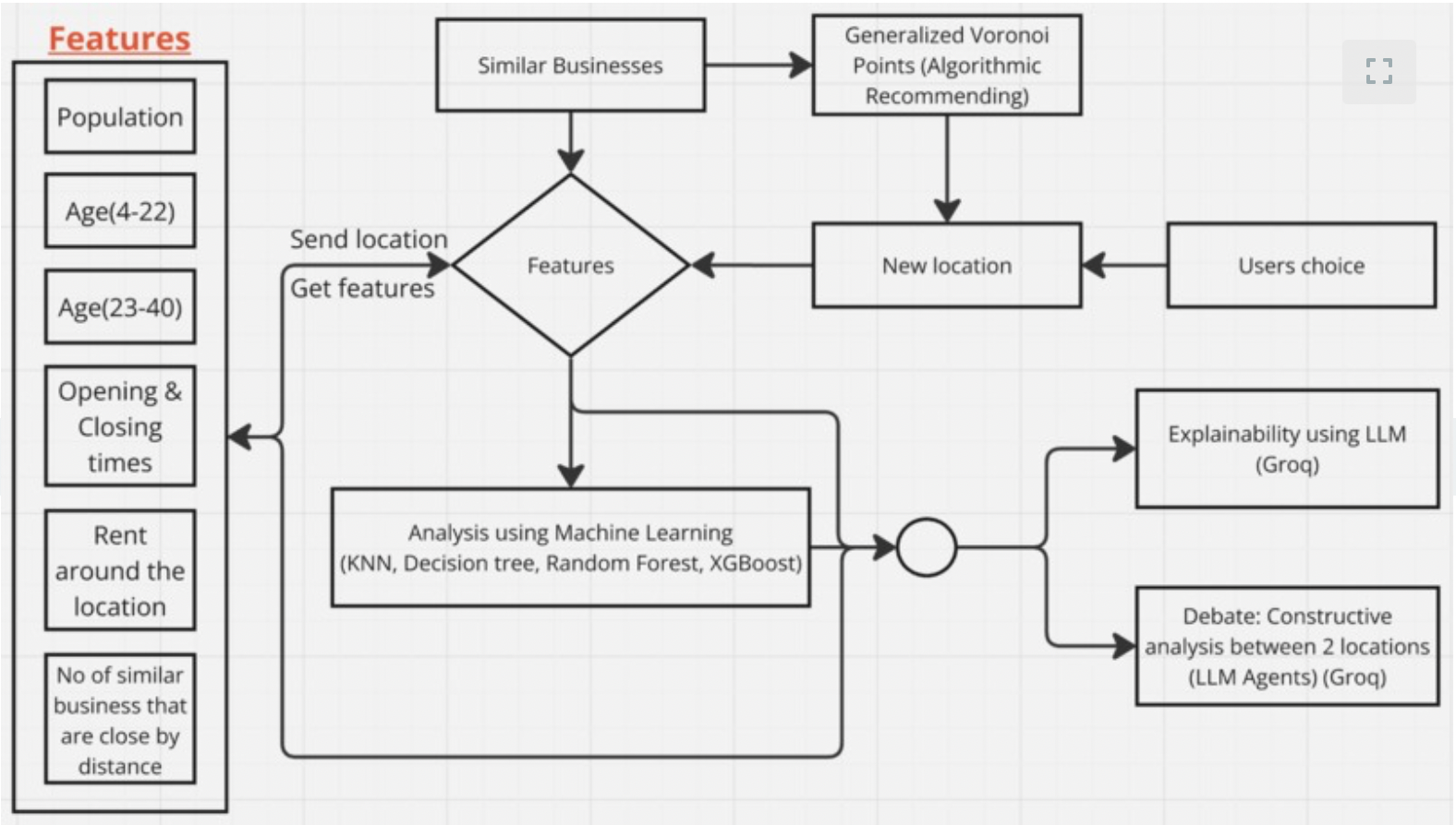
The above is the architecture of our software that we were able to implement as a part of the hackathon.
This data engineering and extraction architecture highlights how we process various factors to recommend business locations. Starting with key demographic features—like population, age groups, rental costs, and operating hours—we apply postprocessing steps such as one-hot encoding to prepare data for machine learning. Additionally, we use probabilistic heat maps to evaluate location attractiveness based on proximity to other companies and schools, quantified as areas under respective curves. Our pipeline also leverages the Serper API for real-time data scraping and Groq for advanced parsing, while Generalized Voronoi Diagrams and Manhattan distances help us spatially analyze and pinpoint optimal locations. This structured approach ensures that each recommendation is both data-driven and contextually relevant.
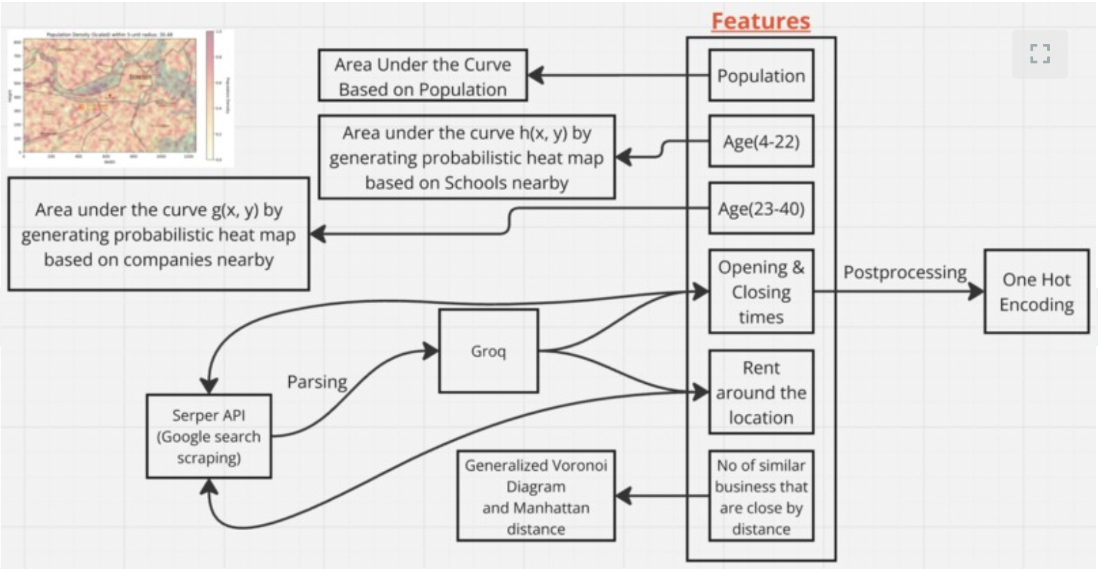
The above is the architecture for our data collection and feature extraction process.
Resolution:
We believe that this data-driven approach to location selection will revolutionize how businesses find their ideal environments, fostering vibrant and interconnected commercial ecosystems. This pilot study is only the beginning, and our vision is to scale these insights to reshape urban landscapes. Much like the precision of a well-designed blueprint, our models empower stakeholders to envision a balanced, data-backed future for cities—similar to how SimCity allows us to thoughtfully construct virtual worlds.
To advance these simulations to a larger scale, incorporating millions of data points and refining our models with advanced compute resources, we are actively seeking support through partnerships and funding. With your support, we can further enhance our simulations, optimizing the process to recommend safer, smarter, and more dynamic locations for businesses. Together, we can create a framework that not only benefits individual enterprises but also contributes to the growth of healthier, more connected communities.